Speed Compliance Tool
Analysing speed compliance on local roads
A powerful yet easy-to-use solution providing access to information about speed limits and average speeds on roads across Great Britain, set-up to focus on your local area. A vital tool for triaging your network to identify locations where problematic traffic speeds might need to be addressed through additional engineering and enforcement measures. The online dashboard is priced on a per-user basis or included within an ACUITY package.
Enhancing Road Safety with Speed Data
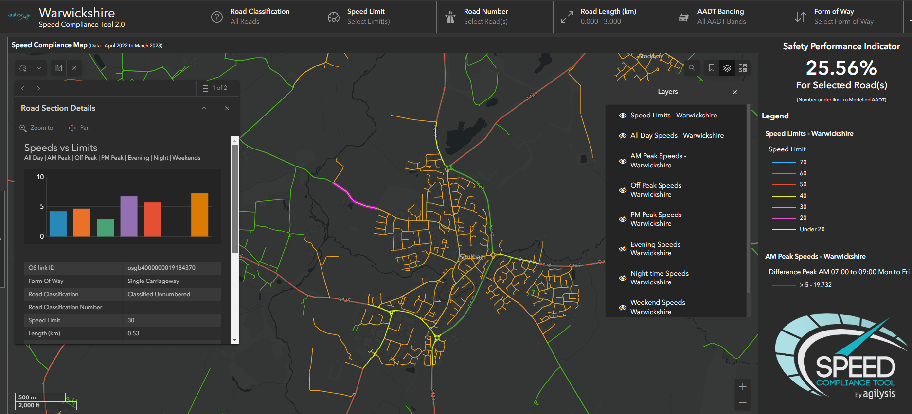
The data is sourced from 135 thousand vehicles which provide GPS data tracks every 10th of a second. This raw data is processed to provide average speeds for the OS Highways network layer resulting in 14 billion vehicle tracks. When used in association with the speed limit data it allows users to quickly identify non-compliance hotspots. We offer an advanced 'Plus' version which includes additional speed metrics plus modelled daily flow for every road.
Speed Data Benefits
The information is useful for local authorities and police forces who want to understand more about how vehicles are travelling on their network, without having to commission individual speed surveys, or need to assess speeding complaints from members of the public. Users can see average vehicle speeds in seconds to make judgements on the appropriate next steps, whether that is a simple response stating that there is no significant issue, a requirement for further investigation, or escalation as a part of a speed management strategy.
User-Friendly Speed Dashboards
Customers access the data through an easy-to-use interface built by Agilysis’ geospatial experts and presented on the powerful ArcGIS Online platform by Esri. Each dashboard shows speed limits for individual road segments based on the OS MasterMap Highways network, with six extra values supplied for average vehicles speeds at different times of the day and week. Coverage is widespread for the vast majority of roads and the interactive tools allow users to select multiple roads based on road number, speed limit, form of way, or via manual selection.

Speed Compliance Tool
(Two users)
£3500
Pricing for local authorities, police forces, and fire & rescue services. Larger areas for regions and partnerships available on request.
*Large, multi-authority police force areas are subject to bespoke pricing
Features include:
- Speed limits layer
- Annual average speed data (including all day average)
- Online Dashboard
- 85th Percentile Speed data (including all day average)
- Modelled Daily Flow
Speed Compliance Tool
(Extra users)
£500per annum
- Add extra named user
Customer Testimonials

The Speed Compliance Tool from Agilysis has been a game changer for us in the way in which we conduct speed enforcement. It allows for quick analysis of 85th percentile data, ensuring that we tackle non-compliance on our roads where intervention is most needed, without spending too much time waiting on traditional road survey completion before we can act. This has helped us greatly in better serving our communities in South Yorkshire.

It’s better value for money when comparing license costs with costs for commissioning physical speed surveys.

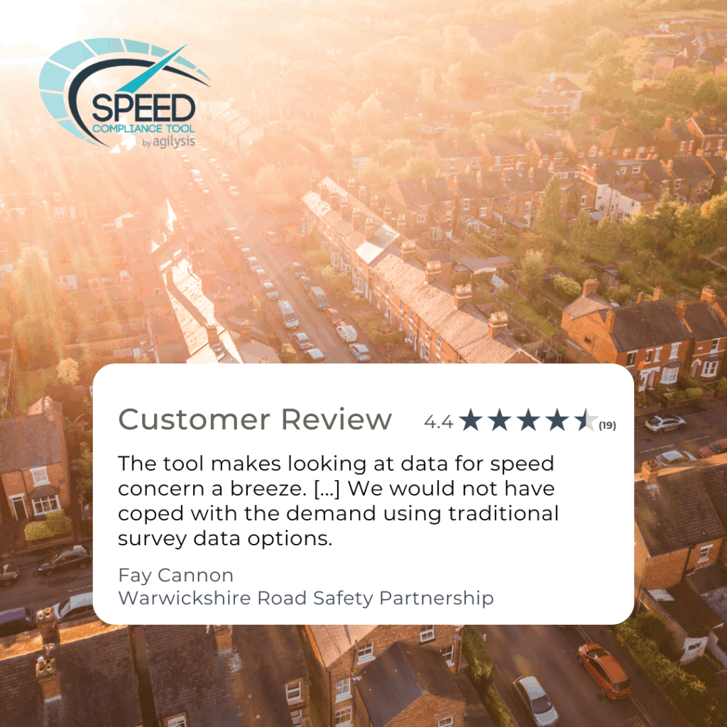
The tool makes looking at data for speed concern a breeze. To date we had over 900 submissions through the central reporting system and we would not have cope with the demand using traditional survey data options.

We were able to provide a better service and using the SCT to triage locations, so an SDR survey was no longer the automatic go to option. We now are beginning to see a more manageable queue for survey locations across the county and able to direct resources where needed.

Everything is going well with the Speed Compliance Tool and I have been finding it very useful to give us an idea of traffic conditions when we have no survey data.
I couldn’t give anything but a fully glowing review. Obviously, I know behind-the-scenes improvements are constantly being worked on with the Speed Compliance Tool and other products that you have, but so far our usage of the SCT and working with Agilysis has been superb!

The Speed Compliance Tool is often the first system I use when answering both internal and external queries into speeding issues on the roads of Derbyshire. Overall, I have been very pleased with the system since we have had it, and the latest version 3 has shown a lot of improvements, which I have found very useful. It is a very cost-effective system and easy to use. The staff at Agilysis are also on hand to assist if there is an issue or suggestion which could be useful.

This tool enables us to streamline our processes significantly by allowing us to instantly assess complaints and provide a response. I found that in 70% of comparisons, the SCT is within 1mph accuracy when looking at the 85th %ile of a physical roadside surveys. There are many factors to consider about the comparison, but the results have given us confidence in using the tool as a reference guide instead of physical surveys moving forward.
Speed Compliance Tool Customer Success Stories
- Oxfordshire found the 85th percentile speeds from SCT to be very close to tube survey results. That exercise gave us confidence to use SCT data across the wider network.
- With reliable data on hand, North Somerset Council could respond quickly and confidently, removing the guesswork from community engagement. This shift has enabled faster, evidence-based responses, smarter prioritisation of resources, improved internal confidence in decision-making, and continuous oversight of the entire road network, rather than just isolated project areas.
- Whether addressing a complex speed complaint or responding to a single resident query, the impact was clear for Safer Roads Humber. Now, the team operates faster, with confidence and clarity. Speeding complaints are resolved in real-time. Valuable time and budget once spent on survey logistics are redirected into proactive road safety work
- The tool makes looking at data for speed concern a breeze. To date we had over 900 submissions through the central reporting system and we would not have cope with the demand using traditional survey data options


