Active Streets Assessment Tool
Analysing and planning for active travel
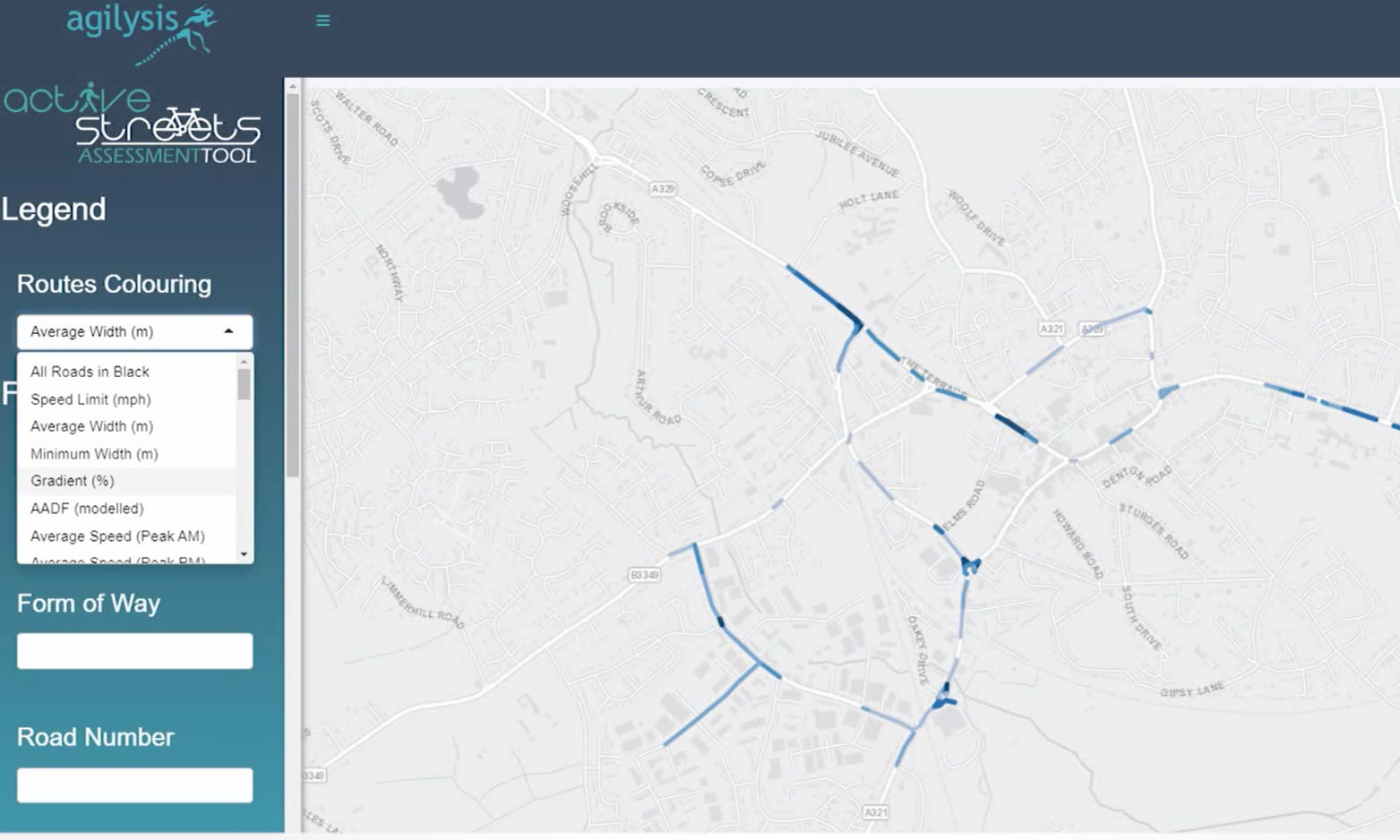
Identifying appropriate locations for new segregated cycleways, footpaths, point closures, and area-wide measures can now be undertaken quickly and effectively using the new Active Streets Assessment Tool. This tool embraces detailed network infrastructure data from Ordnance Survey Master Map, enhanced with additional datasets for individual road sections including network flow, average speeds, 85th percentile speeds, modelled congestion, and collision history.
Agilysis have been supplying local roads collision analysis for a number of years with customers from local authorities as well as large fleets. Our methodologies have been honed by constant conversations with end users and an increased use of cutting-edge technology. We have advanced our methods sufficiently to be able to provide a large quantity of analysis for the whole of GB, or individual areas.
Our data is regularly updated and comes form reliable sources, and we are also able to incorportate custom data supplied by clients subject to negotiation.
Active Streets Assessment Tool
-
Based on the highly-detailed OS Mastermap Highways network
-
Additional datasets added including speed limits plus detailed profiles of average and 85th percentile speeds
-
Modelled AADF (flow) for roads indicating traffic levels
-
Daily congestion index including separate value for AM and PM peaks
-
Estimation of high-pedestrian traffic locations
-
5 years of collision data including separate measure for pedestrian and cyclist collision densities
-
Multiple filters based on road attributes including road widths, plus many of the calculated metrics
-
Export data selections to local systems for further analysis and modelling
-
Optimised for modern web browsers and mobile devices
Active Streets Assessment Tool
(Up to 4 Users)
£4595
Pricing per local authority area for up to 4 users.
Features include:
- Based on highly detailed OS Mastermap Highways network
- Speed limit, Average speed and 85th Percentile speed data
- Modelled AADF (Flow)
- Congestion Index
- Estimation of high-pedestrian traffic locations
- 5 Years collision data